File:Genericmap.png
From The Shartak Wiki
Jump to navigationJump to search
Genericmap.png (734 × 391 pixels, file size: 14 KB, MIME type: image/png)
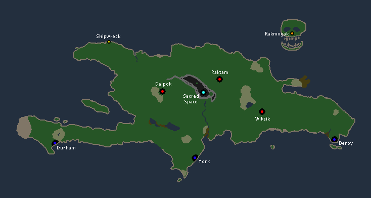
A softly-colored map of terrain types and camp locations.
File history
Click on a date/time to view the file as it appeared at that time.
| Date/Time | Thumbnail | Dimensions | User | Comment | |
|---|---|---|---|---|---|
| current | 04:54, 2 February 2009 |  | 734 × 391 (14 KB) | Cheesesteak (talk | contribs) | Updated with Rakmogak and Sacred Space |
| 19:44, 18 May 2008 |  | 734 × 343 (10 KB) | Zeek (talk | contribs) | A softly-colored map of terrain types and camp locations. | |
| 20:13, 14 May 2008 |  | 734 × 343 (9 KB) | Zeek (talk | contribs) | A softly-colored map of terrain types and camp locations. Updated with new geography. | |
| 23:15, 6 June 2006 |  | 734 × 343 (5 KB) | Elembis (talk | contribs) | A softly-colored map of terrain types and camp locations. | |
| 03:15, 5 June 2006 |  | 734 × 343 (5 KB) | Elembis (talk | contribs) | A softly-colored map of terrain types and camp locations. |
- You cannot overwrite this file.
File usage
The following 3 pages uses this file:
