File:Durham Expressway.png
Durham_Expressway.png (734 × 343 pixels, file size: 69 KB, MIME type: image/png)
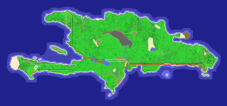
This is a guide for constructing a toll road between Durham, the shipwreck, and Derby without intersecting other settlements. Not all lines need to be constructed and some may be moved to benefit from existing roads. Shortest does not mean straitest or fastest as these roads rely partly on the game's absence of Pythagoreanly correct distances.
Orange and Yellow is the shortest land path between Durham and the shipwreck. Yellow encompasses the area in which the path can be constructed. Black are paths avoiding non jungle squares. Red and White is the shortest swampless path from the junction to Derby. White encompasses the area in which the path can be constructed and cross the river. Grey are possible spurs or range of spurs.
File history
Click on a date/time to view the file as it appeared at that time.
| Date/Time | Thumbnail | Dimensions | User | Comment | |
|---|---|---|---|---|---|
| current | 11:53, 6 August 2007 | | 734 × 343 (69 KB) | Darkferret (talk | contribs) | This is a guide for constructing a toll road between Durham, the shipwreck, and Derby without intersecting other settlements. Not all lines need to be constructed and some may be moved to benefit from existing roads. Shortest does not mean straitest or fa |
- You cannot overwrite this file.
File usage
There are no pages that use this file.